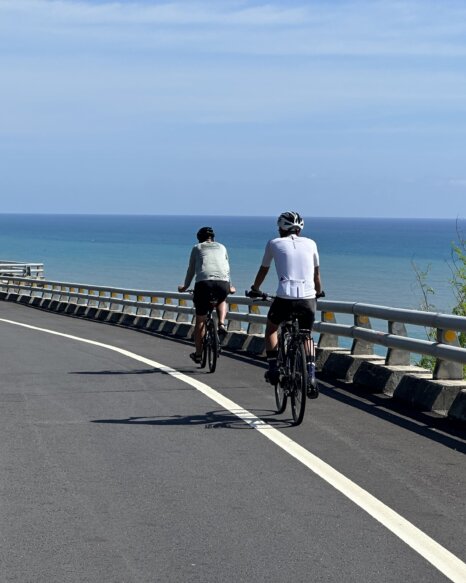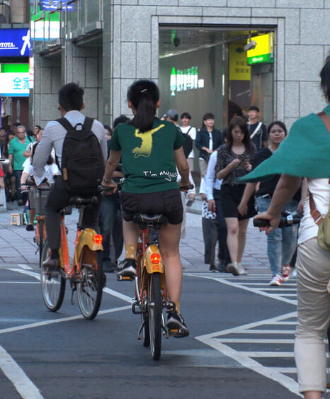
The Four Extreme Points Cycling Tour Around Taiwan is a 1,100 km adventure connecting the island’s northernmost, easternmost, southernmost, and westernmost tips — Fugui, Sandiaojiao, Eluanbi, and Guoshengpu. More than a typical loop, this route includes strategic detours that test your endurance while showcasing Taiwan’s diverse coastlines and iconic lighthouses. This guide helps you plan your route, set your pace, and prepare the gear for a ride that blends challenge with deep island discovery.
Guide to Taiwan’s Four Extreme Points Cycling Route
What Is the Four Extreme Points Cycling Tour — and Why Is It Becoming a Must-Do Ride in Taiwan?
Definition of the Four Extreme Points Cycling Tour Around Taiwan
The Four Extreme Points Cycling Tour refers to a round-island ride that includes intentional detours to Taiwan’s four geographical extremes: Fugui Cape in the north, Sandiaojiao in the east, Eluanbi in the south, and Guoshengpu in the west. These four lighthouses form the outermost corners of the island, and connecting them by bike creates a complete and symbolic journey. This route not only adds distance and difficulty to the standard island loop but also brings deeper meaning and a greater sense of achievement to the ride.
How long is a full loop around Taiwan? The Four Extreme Points route covers at least 1,200 km.
How It Differs from a Standard Cycle Route 1
Unlike the typical round-island cycling route that follows Taiwan’s coastal highways, the Four Extreme Points ride requires extra effort — and careful planning. Each of the four points lies slightly off the main loop, meaning riders must make additional detours into remote or less-traveled areas. For example, reaching Guoshengpu Lighthouse in the west involves riding through narrow rural roads, while Fugui Cape in the north includes a short walking path to the lighthouse.
These detours increase the total distance, elevate the physical challenge, and often bring riders through lesser-known yet scenic landscapes. Rather than just circling Taiwan, this ride adds purpose and symbolic depth by reaching all four directional boundaries of the island.
How long is a full loop around Taiwan? A traditional cycling tour covers approximately 900 to 1,000 km.
Why the Four Extreme Points Ride Is a Unique Challenge
As cycling around Taiwan becomes more popular, seasoned riders are looking for ways to level up their experience — and the Four Extreme Points Ride is the perfect next step. It blends physical endurance with symbolic accomplishment, turning the journey into a true milestone.
Beyond the stats and mileage, many cyclists are drawn to the emotional satisfaction of reaching Taiwan’s outer edges. Ticking off each point adds motivation, meaning, and a sense of purpose to the ride.
For some, it’s a personal challenge. For others, it’s a story worth sharing — one that proves they’ve gone the distance, in every direction.
Read More: Cycling in Taiwan in 2025: Essential Pre-Trip Guide
Where Are Taiwan’s Four Extreme Points? Location, Highlights, and Check-In Tips
MathewBike has prepared a complete cycling map of the Four Extreme Points route, along with GPS coordinates for each location.
Location | Longitude | Latitude |
Fugui Cape Lighthouse | 25.2675 | 121.5015 |
Sandiao Cape Lighthouse | 25.0594 | 121.8832 |
Eluanbi Lighthouse | 21.9442 | 120.8237 |
Guosheng Lighthouse | 23.0828 | 120.1589 |
All four lighthouses are open to the public 24/7 and do not require an entrance fee, making them perfect check-in spots for cyclists.
Each lighthouse is equipped with basic facilities such as parking areas and restrooms. Some locations even have drinking water stations, so you won’t need to worry about resupplying.
To complete a true Four Extreme Points Cycling Tour, you’ll need to physically ride to Taiwan’s northernmost, easternmost, southernmost, and westernmost locations — and check in at each lighthouse with a photo to document your achievement. Below are the exact locations and key features of each point, helping you plan your route with clarity and purpose.
📍 GPS Coordinates: 25.2971° N, 121.5299° E
🗺️ How to Get There: Ride along the north coast highway from Tamsui or Sanzhi, then take the access road to the Fugui Cape trailhead.
📸 Why Visit: Taiwan’s northernmost lighthouse offers ocean views and a clean coastal breeze. Built during the Japanese era, it stands as a historic maritime symbol.
🚴 Tip: The lighthouse is accessible via a short walking trail (~1 km) from the main road. You’ll need to walk or push your bike.
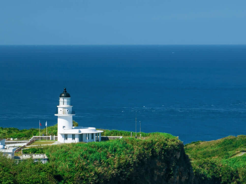
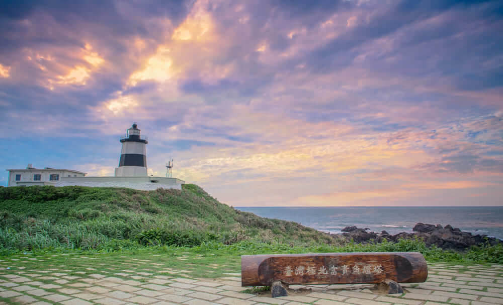
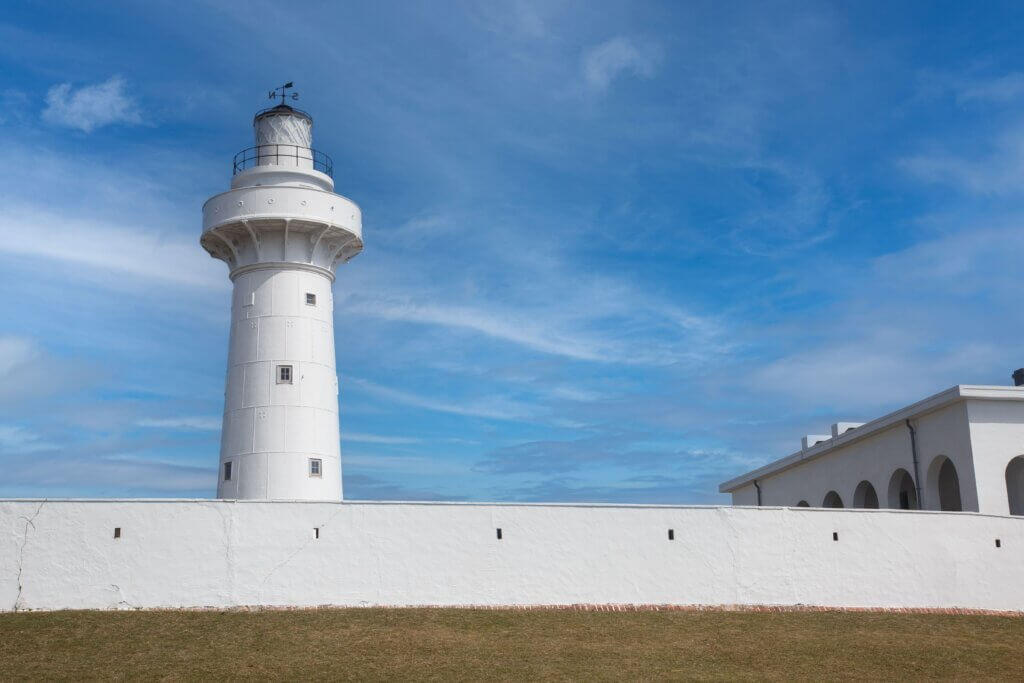
📍 GPS Coordinates: 25.0056° N, 121.9421° E
🗺️ How to Get There: Head south from Fulong along the northeast coastal route. You can detour up to the lighthouse from Gongliao District.
📸 Why Visit: Known as “Taiwan’s Eastern Eye,” this lighthouse overlooks the Pacific Ocean and marks the official eastern edge of the island.
🚴 Suggested route: Combine it with the Old Caoling Loop Bike Trail for an enjoyable ride with scenic views and tunnels.
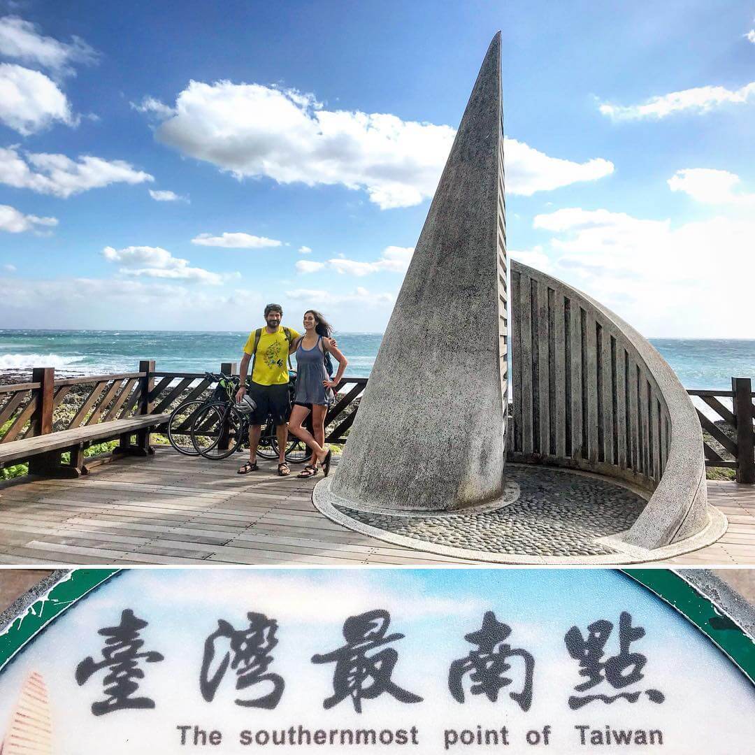
📍 GPS Coordinates: 21.8995° N, 120.8522° E
🗺️ How to Get There: Ride from Hengchun toward Kenting National Park and follow signs to Eluanbi Park.
📸 Why Visit: Taiwan’s southernmost lighthouse is a famous tourist spot. The area is well developed with shops, rest stops, and wide ocean views.
🌞 Caution: Expect heat and strong sun, especially on exposed coastal roads. Bring sun protection and hydrate often.
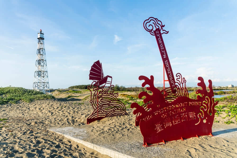
Westernmost Point – Guosheng Lighthouse (Tainan City)
📍 GPS Coordinates: 23.8556° N, 120.0594° E
🗺️ How to Get There: From Provincial Highway 17 in Tainan, detour into rural roads near Qigu District to reach the lighthouse area.
📸 Why Visit: Set against a backdrop of salt fields and wetlands, this remote lighthouse marks Taiwan’s western edge and is a peaceful yet rewarding destination.
🚴 Tip: Visit during daytime for better navigation. Nearby attractions include Qigu Salt Mountain and black-faced spoonbill habitats.
How to Plan Your Four Extreme Points Route — Clockwise vs. Counterclockwise
Planning a Four Extreme Points cycling tour around Taiwan takes more than just picking a start date — you’ll need to decide which direction to ride, how to link the four points, and how to manage your daily distances. Here’s how to choose the right strategy based on your goals, terrain preferences, and pacing.
Clockwise Route (North → East → South → West → North)
Many riders choose the clockwise direction, as it allows the body to gradually adapt. You begin with relatively easy west coast terrain and save the challenging east coast climbs for later, when you’re already in the rhythm of the ride.
✅ Suggested Breakdown (10-Day Example):
| Day | Route | Distance | Notes |
|---|---|---|---|
| Day 1 | Taipei → Fugui Cape → Keelung | ~70 km | Reach the northernmost point and rest near the northeast coast |
| Day 2 | Keelung → Sandiaojiao → Yilan | ~85 km | Hit the easternmost point and ride through scenic coastal roads |
| Day 3 | Yilan → Hualien | ~110 km | Long east coast day — be cautious with tunnels and traffic |
| Day 4 | Hualien → Taitung | ~160 km | The most demanding day, with winding coastal climbs |
| Day 5 | Taitung → Eluanbi → Kenting | ~130 km | Southernmost tip reached — enjoy ocean views |
| Day 6 | Kenting → Kaohsiung | ~120 km | Begin west coast return — smoother, flatter roads |
| Day 7 | Kaohsiung → Tainan → Guosheng | ~90 km | Reach the westernmost point — detour required |
| Day 8 | Guosheng Lighthouse → Chiayi → Yunlin | ~80 km | Relaxed rural stretch |
| Day 9 | Yunlin → Miaoli → Taoyuan | ~120 km | Long day but mostly flat |
| Day10 | Taoyuan → Taipei | ~80 km | Ride back to your starting point — mission complete! |
Counterclockwise Route (North → West → South → East → North)
The counterclockwise direction brings challenges earlier in the tour, especially with city traffic and constant stops along Taiwan’s densely populated west coast. However, it saves the east coast — Taiwan’s most scenic stretch — for the final days, which can feel like a rewarding conclusion.
✅ Suggestion Routes for:
Day 1-2: Taipei → Taoyuan → Hsinchu → Miaoli (mainly along the West Coast Expressway)
Day 3-4: Taichung → Changhua → Tainan → Qigu (leading to Guosheng Lighthouse)
Day 5-6: Kaohsiung → Pingtung → Eluanbi (reaching the southernmost point)
Day 7-8: Pingtung → Taitung → Hualien
Day 9-10: Hualien → Yilan → Sandiaojiao
Day 11-12: Keelung → Fugui Cape → Taipei (completing the full loop)
✅ Good For:
1. Cyclists who are already used to busy traffic
2. Those who want to save the best views for last
3. Riders starting from southern or western cities
How to Connect the Four Extreme Points with Taiwan’s Classic Cycling Spots
Planning a route that hits all four extreme points doesn’t mean skipping Taiwan’s iconic cycling highlights — in fact, with the right detours, you can enjoy the best of both.
Balance the Mission and the Experience
While the Four Extreme Points ride is about reaching Taiwan’s geographic limits, it also offers the perfect opportunity to explore the island’s cultural and scenic landmarks. To do this, you’ll need to plan a loop that includes brief detours both inland and along the coast.Recommended Highlights Along the Route
Here are some classic stops you can easily incorporate:
North Coast:
Before or after visiting Fugui Cape, ride through Tamsui Old Street, Baishawan, or detour inland to Yangmingshan National Park.East Coast:
Between Yilan and Taitung, you’ll encounter breathtaking spots like Qingshui Cliffs, Sanxiantai, Tropic of Cancer Marker, and Dulan Bay.South Coast:
After reaching Eluanbi Lighthouse, enjoy Kenting National Park, Longpan Park, and the local night market for a cultural recharge.West Coast:
While heading to Guoshengpu Lighthouse, stop by Qigu Salt Mountain, Beimen Church, or explore Tainan’s historic district.
Daily Distance & Recommended Duration
The total distance of the Four Extreme Points Cycling Tour is around 1,100 to 1,200 km, depending on your exact route and detours. How many days you need depends on your riding style, experience, and goals.
Here’s a breakdown of three common ride plans:
7-Day Plan – For Advanced Cyclists
| Day | Route | Distance | Notes |
|---|---|---|---|
| Day 1 | Taipei → Fugui Cape → Keelung | 100–120km | Northernmost point |
| Day 2 | Keelung → Sandiaojiao → Yilan → Hualien | 160km | Easternmost point |
| Day 3 | Hualien → Taitung | 160km | Long and hilly |
| Day 4 | Taitung → Eluanbi → Hengchun | ~140km | Southernmost point |
| Day 5 | Hengchun → Kaohsiung → Tainan → Qigu | ~160km | Westernmost point |
| Day 6 | Qigu → Yunlin → Taichung | ~150km | Flat farmland route |
| Day 7 | Taichung → Miaoli → Taipei | 120km | Return to start 🎉 |
🔴 For experienced riders who can handle long distances and minimal rest.
10-Day Plan – Balanced Challenge
| Day | Route | Distance | Notes |
|---|---|---|---|
| Day 1 | Taipei → Fugui Cape → Keelung | ~80km | Scenic start |
| Day 2 | Keelung → Sandiaojiao → Yilan | ~85km | Easternmost point |
| Day 3 | Yilan → Hualien | 1~110km | Coastal tunnels & climbs |
| Day 4 | Hualien → Taitung | ~130km | East coast beauty |
| Day 5 | Taitung → Eluanbi → Kenting | ~120km | Southernmost point |
| Day 6 | Kenting → Kaohsiung | 100km | Flatter terrain |
| Day 7 | Kaohsiung → Tainan → Qigu | ~90km | Westernmost point |
| Day 8 | Qigu → Yunlin → Changhua | 80km | Quiet countryside |
| Day 9 | Changhua → Miaoli | ~100km | Mixed terrain |
| Day10 | Miaoli → Taipei | ~100km | Full loop completed |
🟡 Recommended for riders who want a challenge but still enjoy rest, food, and scenery.
14-Day Plan – Leisure & Exploration
| Day | Routes | Distance | Notes |
| Day 1 | Taipei → Fugui Cape | ~60km | Northernmost point |
| Day 2 | Fugui Cape → Sandiaojiao | ~80km | Easternmost point |
| Day 3 | Sandiaojiao → Yilan → Su’ao | ~70km | Coastal ride, scenic tunnels |
| Day 4 | Su’ao → Hualien | ~90km | Cliffs, coastal scenery |
| Day 5 | Hualien → Yuli | ~100km | East Rift Valley |
| Day 6 | Yuli → Taitung | ~90km | Countryside, rice paddies |
| Day 7 | Taitung → Eluanbi → Kenting | ~110km | Southernmost point, beach town |
| Day 8 | Kenting → Hengchun → Fangliao | ~90km | Start west coast return |
| Day 9 | Fangliao → Kaohsiung | ~80km | Urban riding |
| Day10 | Kaohsiung → Tainan → Qigu | ~90km | Westernmost point |
| Day11 | Qigu → Beimen → Chiayi | ~80km | Salt flats, wetlands |
| Day12 | Chiayi → Yunlin → Changhua | ~85km | Flat rural roads |
| Day13 | Changhua → Miaoli | ~90km | Rolling hills |
| Day14 | Miaoli → Taipei | ~100km | Return to start, complete loop |
📌 Tour Highlights Overview
✅ Visit all four of Taiwan’s geographic extremes: Fugui Cape (Sanzhi), Sandiaojiao (Gongliao), Eluanbi (Hengchun), and Guosheng (Qigu)
✅ Well-paced itinerary with daily rides averaging 60–100 km — perfect for travelers who enjoy time for photos, meals, and rest
✅ Flexibility to add hot springs, local cuisine, and scenic spots — combining the joy of travel and cycling
✅ Flexibility to adjust daily distance using trains or support vehicles when needed
Essential Gear for the Four Extreme Points Cycling Tour
Long-distance cycling in Taiwan — especially a ride covering all four geographic extremes — demands more than just determination. The right gear can make the difference between a smooth adventure and a rough ride. Here’s what you’ll need:

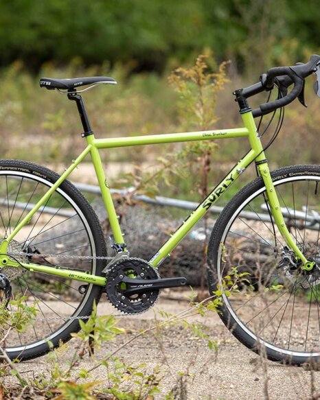
Bike & Core Cycling Equipment
| Items | Suggestions | Notes |
| Road Bike / Touring Bike / Gravel Bike | Lightweight, well-geared, and in good condition | We recommend having bike lights, a water bottle cage, and a cargo rack. |
| Helmet | Certified, well-ventilated for long rides | We recommend adding reflective stickers for nighttime visibility. |
| Cycling Clothing | Padded shorts, breathable jersey, rainproof layers, arm sleeves | Two sets of spare clothes. |
| Gloves & Eyewear | Enhances grip, comfort, and eye protection | Essential for long distances. |
| Cycling shoes / socks | We recommend clipless pedals with cycling shoes or comfortable athletic shoes. | Best for ventilation and quick-drying |
Weather Protection
| Items | Suggestions | Notes |
| Lightweight Windbreaker / Rain Jacket | Protects against wind, sudden rain, and temperature drops | Essential, especially with the variable weather in eastern Taiwan. |
| Sun Protection | Sunscreen, sun sleeves, lip balm for UV defense | Refuel every 2-3 hours. |
| Cycling Cap or Buff | Useful for sun, sweat, and wind protection | Useful for nighttime or mountainous areas. |
| Warm jacket (windbreaker/down jacket) | For winter riding | The temperature difference between day and night in mountainous areas is significant. |
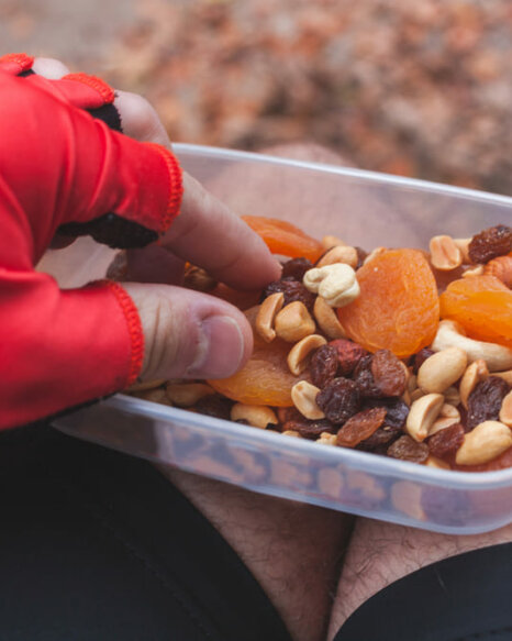
Nutrition Gear
| Items | Suggestions | Notes |
| Water bottles x2 | Stay hydrated throughout long rides | Can be used with a quick-release water bottle cage. |
| Salt tablets / electrolyte powder | Replenishes energy, prevents cramps. | Essential for summer and mountainous weather. |
| Energy Snacks | Bring bars, gels, trail mix, or nuts | One every 2 hours. |
| Snacks / emergency rations | Nuts, beef jerky, crackers, etc. | Helpful when there are no shops in rural areas. |
Read More: Fuel Your Ride: 7 Essential Cycling Nutrition Tips for Peak Performance
Navigation, Repair & Nutrition Gear
| Items | Suggestions | Notes |
| Phone and Mount | Connection while riding | Can be paired with a handlebar bag designed for power banks. |
| Power Bank (10,000mAh+) | Recharge phone, lights, or GPS device on the road | Pairs with fast-charging cables. |
| Cycling Computer | Track distance, speed, and directions while riding | Ex:Bryton、Garmin |
| Front and Rear Lights | Required for tunnels, night rides, and early starts | A must-have for riding at night and through tunnels. |
Safety & Repair
| Items | Suggestions | Notes |
| Repair kits (inner tubes, mini pump, tire levers) | Make sure to have at least 1 or 2 spare tubes with you. | Fix flats quickly during your ride |
| Multi-tool (Includes Allen keys, etc.) | Adjust the saddle, gears (derailleurs), and brakes, etc. | Pre-ride check and mid-ride adjustments. |
| Reflective vest | Useful at campsites or dark rest areas | Enhances visibility. |
| Bike Lock | Useful for overnight stays or city stops | Consider bringing a medium-sized steel lock. |
Personal Hygiene & Essentials
| Items | Suggestions | Notes |
| Passport / Personal ID | We suggest keeping a photocopy as a safeguard. | Can be stored in a waterproof bag |
| Cash + Easy Card | Some locations do not accept electronic payments | Bring some cash / coin for emergencies. |
| Medications / Prescriptions | Be prepared for muscle soreness, colds, and diarrhea | Keep a small first-aid kit in your daypack |
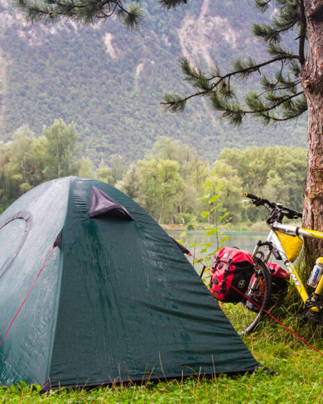
| Quick-Dry Towel | Suitable for overnight stays and camping | Lightweight and dries fast — perfect for travel |
The Appeal and Challenge of the Four Extreme Points Cycling Tour
Total Distance and Estimated Duration
Why the Four Extreme Points Ride Is More Challenging
🗺️ Beyond a standard round-island ride
Unlike the typical route that follows Taiwan’s coastline, this tour includes detours to four geographic extremes.
📍 Four geographic landmarks you must reach:
Fugui Cape Lighthouse – Northernmost point
Sandiaojiao Lighthouse – Easternmost point
Eluanbi Lighthouse – Southernmost point
Guoshengpu Lighthouse – Westernmost point
➕ Added distance and complexity
These extra segments bring the total route to approximately 1,100–1,200 km, which is 100–150 km longer than the usual 900–1,000 km coastal loop.
Estimated Duration for the Tour
🚴♂️ Standard pace:
If you ride 80–100 km per day, you can expect to complete the tour in 10 to 14 days.
🔥 For advanced cyclists:
Some experienced riders finish in just 7 days, but this requires strong endurance, efficient planning, and familiarity with Taiwan’s terrain.
🛠️ Key considerations:
Be prepared for detours and varied road conditions
Leave buffer time for weather, fatigue, or mechanical issues
📌 Pro Tip: Each extreme point requires a deliberate detour — known as an “in-and-out” segment — so be sure to include these in your total distance planning.
Difficulty Levels and Riding Recommendations
The Four Extreme Points cycling tour offers varying degrees of difficulty, depending on your route, pace, and experience level. Here’s a breakdown to help you choose the right approach:
| Level | Suggested Duration | Rider Profile | Features |
|---|---|---|---|
| 🟢 Easy & Leisure | 14+ days | First-time tourers, casual riders | 60–80 km per day, more time to enjoy scenery and rest |
| 🟡 Standard Challenge | 10 days | Intermediate cyclists with one full tour completed | 90–120 km per day, balance between effort and exploration |
| 🔴 Advanced Challenge | 7–8 days | Experienced cyclists with strong endurance | 120–160 km per day, physically demanding, requires planning and training |
Each rider should assess their fitness level and cycling experience before choosing a route plan. Be sure to reserve 1–2 buffer days for unexpected weather, mechanical issues, or rest. The route’s total distance and the detours to the four extreme points require thoughtful pacing and flexibility.
Who Should Take on This Journey?
The Four Extreme Points Cycling Tour Around Taiwan isn’t just for elite athletes — it’s a meaningful challenge suited for several types of riders:
1. Experienced cyclists who have completed a round-island ride
Looking to elevate their next bike tour in Taiwan
Enjoy setting clear goals and visiting iconic geographic landmarks2. Slow travelers seeking immersive exploration
Prefer breaking up the journey into smaller segments
Love turning each stop into a story, from coastal towns to remote lighthouses3. Content creators and outdoor storytellers
Capture stunning visuals along Taiwan’s coastline and countryside
The four extreme points offer excellent photo ops and personal milestones
4. Adventure seekers who enjoy physical and mental challenges
Value solitude, discipline, and the emotional reward of pushing limits
Ready to explore Taiwan beyond tourist spots and through true effort🚴 Whether you’re cycling around Taiwan for the first time or returning for a deeper adventure, this ride lets you connect with the island from edge to edge — and achieve something truly remarkable.
Perfect for turning each extreme point into a personal story and lasting memory.
Outdoor content creators who love documenting their adventures.
A goldmine of photo-worthy spots — from coastlines and lighthouses to wetlands and hot springs.A goldmine o
Completing the Four Extreme Points is a badge of honor in any cyclist’s touring resume.
Adventure lovers drawn to tests of endurance and inner strength
They enjoy the solitude of the ride, finding focus and mental clarity through the intensity of long-distance cycling.
🚴 Whether you’re cycling around Taiwan for the first time or returning for a deeper adventure, this ride lets you connect with the island from edge to edge — and achieve something truly remarkable.
How to Get Certified for Completing the Four Extreme Points Cycling Tour
After completing the Four Extreme Points Tour, why not commemorate it with an official certificate?The certification process is actually quite simple — let MathewBike walk you through what you need to prepare.
Application Process for the Four Extreme Points Cycling Certification
- Registration and Sign-Up
Start by registering on the Cycling Federation of the Republic of China (CFROC) or the official website of the Cycling Life-Style Foundation — both organizations support Four Extreme Points certification.
Certification fees range from NT$100 to NT$2,800, depending on the level of recognition you apply for.
A basic certificate typically costs around NT$100, while premium packages — which may include an official certificate, commemorative T-shirt, and souvenirs — come at a higher price.
- Take a photo at each checkpoint
When you arrive at each lighthouse, make sure to take the following photos:
- A photo of you with the lighthouse in the background.
- A screenshot of your GPS location (to confirm you reached the spot).
- A nearby landmark, such as a road sign or information board.
- Complete ride record.
It’s recommended to use a cycling app or sports watch to track your route — these can serve as supporting evidence for your certification.
Once you’ve finished the ride, simply prepare your photos from the four extreme points along with your ride record — then you’re ready to apply for certification.